Remote Sensing 线上研讨会——灾害科学的发展 | MDPI Webinar
发表时间:2023-04-06 阅读量:302
由 MDPI Remote Sensing 期刊主办的线上研讨会——灾害科学的发展 (Remote Sensing Webinar | Advances in Disaster Science),将于 2023 年 4 月 6 日 7:00 (北京时间) 在 Zoom 网络平台召开。会议由 Magaly Koch 博士 (Remote Sensing 期刊栏目 Environmental Remote Sensing 主编) 担任主席。
此次研讨会,您将有机会与多国专家学者们以在线问答的方式分享和交流最前沿的学术报告,见证该领域的成果与进步。欢迎感兴趣的学者订阅会议,以及时收到会议最新动态。
会议信息
形式:英文线上会议 (免费参会)
时间:2022 年 4 月 6 日 7:00 (北京时间)
网站:https://www.mdpi.com/journal/remotesensing/events/16005
ZOOM 平台直播 ID:822 7632 9470
主题:灾害科学是一门研究学科,它在以下方面起着关键作用:理解地质灾害的潜在过程;评估、模拟和预测灾害风险;设计和实施灾害风险管理政策和方案。本次网络研讨会将概述灾害科学的最新研究进展,包括新的地理空间方法和应用。
会议主席

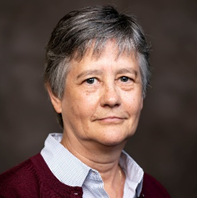
Dr. Magaly Koch
Center for Remote Sensing and Dept. of Earth and Environment, Boston University, Boston, USA
会议副主席

Dr. Shunichi Koshimura
International Research Institute of Disaster Science, Tohoku University, Sendai, Japan
演讲嘉宾

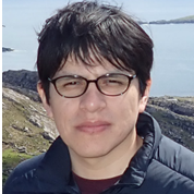
Dr. Bruno Adriano
International Research Institute of Disaster Science, Tohoku University, Sendai, Japan
演讲主题:Advancements in Machine Learning Methods for Disaster Response Using Satellite Imagery

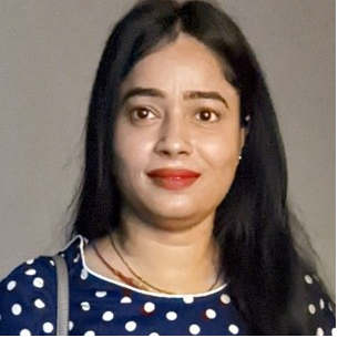
Dr. Nidhi Verma
Center for Remote Sensing, Boston University, Boston, USA
演讲主题:Integrating Radar Backscattering and Flood Water Depth Information for Improved Flood Mapping: A Case Study In Houston City
相关特刊
Technological Advancements in Disaster Damage Assessment Using Earth Observation, Machine Learning, and Numerical Simulation
Edited by Bruno Adriano, Erick Mas, Luis Angel Moya Huallpa, Hiroyuki Miura and Miguel Estrada
Submission Deadline: 31 May 2023
https://www.mdpi.com/journal/remotesensing/special_issues/6HCS5WQAJC
会议组织方

如有任何会议相关问题,请邮件咨询:remotesensing@mdpi.com
Remote Sensing 期刊介绍
主编:Prasad S. Thenkabail, USGS Western Geographic Science Center (WGSC), USA
期刊范围涵盖遥感科学所有领域,从传感器的设计、验证和校准,到遥感在地球科学、环境生态、城市建筑等各方面的广泛应用。
2021 Impact Factor:5.349
2021 CiteScore:7.4
Time to First Decision:19.9 Days
Time to Publication :44 Days